Filter 3,416 quality-approved unusual places by type, continent, best month and weirdness score; compare rankings in cards or a sortable table. These are crawlable research records, not an indiscriminate directory: reports without enough depth remain available for exploration but are excluded from search indexing.
Medieval settlement at Lark Stoke
United Kingdom
human settlement in Admington, Stratford-on-Avon, Warwickshire, England, UK
Map, evidence and context →DESERTED MEDIEVAL VILLAGE · Expanded physical odditiesMedieval settlement earthworks on and around Town Green
United Kingdom
human settlement in Settrington, Ryedale, North Yorkshire, England, UK
Map, evidence and context →DESERTED MEDIEVAL VILLAGE · Expanded physical odditiesMedieval settlement and part of field system at Castletown Farm
United Kingdom
human settlement in Tilston, Cheshire West and Chester, Cheshire, England, UK
Map, evidence and context →DESERTED MEDIEVAL VILLAGE · Expanded physical odditiesMedieval settlement and field system at Walburn Hall
United Kingdom
human settlement in Walburn, Richmondshire, North Yorkshire, England, UK
Map, evidence and context →DESERTED MEDIEVAL VILLAGE · Expanded physical odditiesMedieval settlement, moat and fishponds at Woodhill Park Farm
United Kingdom
human settlement in Clyffe Pypard, Wiltshire, England, UK
Map, evidence and context →DESERTED MEDIEVAL VILLAGE · Expanded physical odditiesMedieval settlement and remains of open fields immediately west of East Stoke village
United Kingdom
human settlement in East Stoke, Newark and Sherwood, Nottinghamshire, England, UK
Map, evidence and context →DESERTED MEDIEVAL VILLAGE · Expanded physical odditiesMedieval settlement, site of quadrangular castle and relict garden between Ilton Farm and Ilton Castle Farm
United Kingdom
archaeological site in Malborough, Devon, England, UK
Map, evidence and context →DESERTED MEDIEVAL VILLAGE · Expanded physical odditiesMedieval settlement remains at Whitcombe
United Kingdom
human settlement in Whitcombe, Dorset, England, UK
Map, evidence and context →DESERTED MEDIEVAL VILLAGE · Expanded physical odditiesMedieval settlement 370m north of Grove Farm
United Kingdom
human settlement in Wighton, North Norfolk, England,UK
Map, evidence and context →DESERTED MEDIEVAL VILLAGE · Expanded physical odditiesMedieval settlement and part of the open field system immediately south of Myddleton Lodge
United Kingdom
human settlement in Ilkley, West Yorkshire, England,UK
Map, evidence and context →DESERTED MEDIEVAL VILLAGE · Expanded physical odditiesMedieval settlement 160m south and 240m south west of Sandford Farm
United Kingdom
human settlement in Wembdon, Sedgemoor, Somerset, England, UK
Map, evidence and context →DESERTED MEDIEVAL VILLAGE · Expanded physical odditiesMedieval settlement remains immediately west of The Vicarage
United Kingdom
human settlement in West Overton, Wiltshire, England, UK
Map, evidence and context →DESERTED MEDIEVAL VILLAGE · Expanded physical odditiesMedieval settlement and cultivation remains at Newtown
United Kingdom
human settlement in Calbourne, Newtown and Porchfield, Isle of Wight, England, UK
Map, evidence and context →DESERTED MEDIEVAL VILLAGE · Expanded physical odditiesMedieval settlement of Babingley
United Kingdom
human settlement in Sandringham, King's Lynn and West Norfolk, Norfolk, England, UK
Map, evidence and context →DESERTED MEDIEVAL VILLAGE · Expanded physical odditiesMedieval settlement at Hartley Mauditt
United Kingdom
human settlement in Worldham, East Hampshire, Hampshire, England, UK
Map, evidence and context →DESERTED MEDIEVAL VILLAGE · Expanded physical odditiesMedieval settlement 350m east of West Burton Dairy
United Kingdom
human settlement in Winfrith Newburgh, Dorset, England, UK
Map, evidence and context →DESERTED MEDIEVAL VILLAGE · Expanded physical odditiesMedieval settlement at Holworth
United Kingdom
human settlement in Chaldon Herring, Dorset, England, UK
Map, evidence and context →DESERTED MEDIEVAL VILLAGE · Expanded physical odditiesMedieval settlement immediately north and 170m south of St John the Baptist's Church, Lower Shuckburgh
United Kingdom
human settlement in Upper and Lower Shuckburgh, Stratford-on-Avon, Warwickshire, England, UK
Map, evidence and context →DESERTED MEDIEVAL VILLAGE · Expanded physical odditiesMedieval settlement including a moated site and open field system, immediately north east and south of Hall Farm
United Kingdom
human settlement in West Markham, Bassetlaw, Nottinghamshire, England, UK
Map, evidence and context →DESERTED MEDIEVAL VILLAGE · Expanded physical odditiesMedieval settlement remains at Overtown
United Kingdom
human settlement in Wroughton, Swindon, Wiltshire, England, UK
Map, evidence and context →DESERTED MEDIEVAL VILLAGE · Expanded physical odditiesMedieval settlement around Anmer Hall
United Kingdom
human settlement in Anmer, King's Lynn and West Norfolk, Norfolk, England, UK
Map, evidence and context →DESERTED MEDIEVAL VILLAGE · Expanded physical odditiesMedieval village earthworks, fishponds and mill leat at Stonton Wyville
United Kingdom
human settlement in Stonton Wyville, Harborough, Leicestershire, England, UK
Map, evidence and context →DESERTED MEDIEVAL VILLAGE · Expanded physical odditiesMedieval settlement remains immediately west of St Pancras's Church
United Kingdom
human settlement in Arlington, Wealden, East Sussex, England, UK
Map, evidence and context →DESERTED MEDIEVAL VILLAGE · Expanded physical odditiesMedieval settlement remains immediately south east of Hutton Hall
United Kingdom
human settlement in Hutton Magna, County Durham, England, UK
Map, evidence and context →DESERTED MEDIEVAL VILLAGE · Expanded physical odditiesMedieval settlement, cultivation remains and boundary 550m north west of Upham Hall
United Kingdom
human settlement in Aldbourne, Wiltshire, England, UK
Map, evidence and context →DESERTED MEDIEVAL VILLAGE · Expanded physical odditiesMedieval settlement immediately south of Halfway Wall, Lundy
United Kingdom
human settlement in Torridge, Devon, England, UK
Map, evidence and context →DESERTED MEDIEVAL VILLAGE · Expanded physical odditiesMedieval settlement remains 500m west of Well Hall
United Kingdom
human settlement in Gayton, King's Lynn and West Norfolk, Norfolk, England, UK
Map, evidence and context →DESERTED MEDIEVAL VILLAGE · Expanded physical odditiesMedieval settlement remains east of Walton Common
United Kingdom
human settlement in East Walton, King's Lynn and West Norfolk, Norfolk, England, UK
Map, evidence and context →DESERTED MEDIEVAL VILLAGE · Expanded physical odditiesMedieval settlement remains immediately east of The Wymeshead
United Kingdom
human settlement in Kegworth, North West Leicestershire, England,UK
Map, evidence and context →DESERTED MEDIEVAL VILLAGE · Expanded physical odditiesMedieval settlement 850m north of St Mary's Church
United Kingdom
human settlement in Charminster, Dorset, England, UK
Map, evidence and context →DESERTED MEDIEVAL VILLAGE · Expanded physical odditiesMedieval settlement at Withybrook
United Kingdom
human settlement in Withybrook, Rugby, Warwickshire, England, UK
Map, evidence and context →DESERTED MEDIEVAL VILLAGE · Expanded physical odditiesDeserted medieval village, moated site, and early medieval timber building at Castle Eden, 200m south of The Castle
United Kingdom
archaeological site in Castle Eden, County Durham, England, UK
Map, evidence and context →DESERTED MEDIEVAL VILLAGE · Expanded physical odditiesMedieval village of Hunton and field system
United Kingdom
human settlement in Hunton, Richmondshire, North Yorkshire, England, UK
Map, evidence and context →DESERTED MEDIEVAL VILLAGE · Expanded physical odditiesMedieval settlement remains 800m south of Manor Farm
United Kingdom
human settlement in Milborne St Andrew, Dorset, England, UK
Map, evidence and context →DESERTED MEDIEVAL VILLAGE · Expanded physical odditiesMedieval settlement of Croxton
United Kingdom
human settlement in Croxton, North Lincolnshire, Lincolnshire, England, UK
Map, evidence and context →DESERTED MEDIEVAL VILLAGE · Expanded physical odditiesMedieval settlement 520m north east of Lower Beversbrook Farm
United Kingdom
human settlement in Calne Without, Wiltshire, England, UK
Map, evidence and context →DESERTED MEDIEVAL VILLAGE · Expanded physical odditiesMedieval settlement remains at Flecknoe
United Kingdom
human settlement in Wolfhampcote, Rugby, Warwickshire, England, UK
Map, evidence and context →DESERTED MEDIEVAL VILLAGE · Expanded physical odditiesMedieval settlement, lordly residence, post medieval gardens and walls immediately south of Howgrave Hall
United Kingdom
human settlement in Howgrave, Hambleton, North Yorkshire, England, UK
Map, evidence and context →DESERTED MEDIEVAL VILLAGE · Expanded physical odditiesMedieval settlement and associated field systems west of Brook Farm
United Kingdom
human settlement in Dilton Marsh, Wiltshire, England, UK
Map, evidence and context →DESERTED MEDIEVAL VILLAGE · Expanded physical odditiesMedieval settlement and early post-medieval garden earthworks around Barlow Hall
United Kingdom
human settlement in Barlow, Selby, North Yorkshire, England, UK
Map, evidence and context →DESERTED MEDIEVAL VILLAGE · Expanded physical odditiesMedieval settlement of Pockthorpe at Pockthorpe Hall
United Kingdom
human settlement in Nafferton, East Riding of Yorkshire, England, UK
Map, evidence and context →DESERTED MEDIEVAL VILLAGE · Expanded physical odditiesMedieval settlement at West Ringstead
United Kingdom
human settlement in Osmington, Dorset, England, UK
Map, evidence and context →DESERTED MEDIEVAL VILLAGE · Expanded physical odditiesMedieval settlement and prehistoric hut circle settlement 870m north east of Washfold Farm
United Kingdom
human settlement in Bellerby, Richmondshire, North Yorkshire, England, UK
Map, evidence and context →DESERTED MEDIEVAL VILLAGE · Expanded physical odditiesMedieval settlement and open field system immediately north of Old Hall
United Kingdom
human settlement in Hulland, Derbyshire Dales, Derbyshire, England, UK
Map, evidence and context →DESERTED MEDIEVAL VILLAGE · Expanded physical odditiesMedieval settlement 400m south west of Crew's Farm
United Kingdom
human settlement in Dauntsey, Wiltshire, England, UK
Map, evidence and context →DESERTED MEDIEVAL VILLAGE · Expanded physical odditiesMedieval settlement of Whaddon, 260m west of Whaddon Grove Farm
United Kingdom
human settlement in Hilperton, Wiltshire, England, UK
Map, evidence and context →DESERTED MEDIEVAL VILLAGE · Expanded physical odditiesOgle moated site, medieval village and open field system
United Kingdom
archaeological site in Whalton, Northumberland, England, UK
Map, evidence and context →DESERTED MEDIEVAL VILLAGE · Expanded physical odditiesMedieval settlement immediately north west of Upper Littlecott Farm
United Kingdom
human settlement in Hilmarton, Wiltshire, England, UK
Map, evidence and context →DESERTED MEDIEVAL VILLAGE · Expanded physical odditiesMedieval settlement, including fishpond and open field system, immediately north and 240m south of Lea Cottage Farm
United Kingdom
human settlement in Tissington and Lea Hall, Derbyshire Dales, Derbyshire, England, UK
Map, evidence and context →DESERTED MEDIEVAL VILLAGE · Expanded physical odditiesMedieval settlement and open field system immediately south east of Low Farm
United Kingdom
human settlement in West Burton, Bassetlaw, Nottinghamshire, England, UK
Map, evidence and context →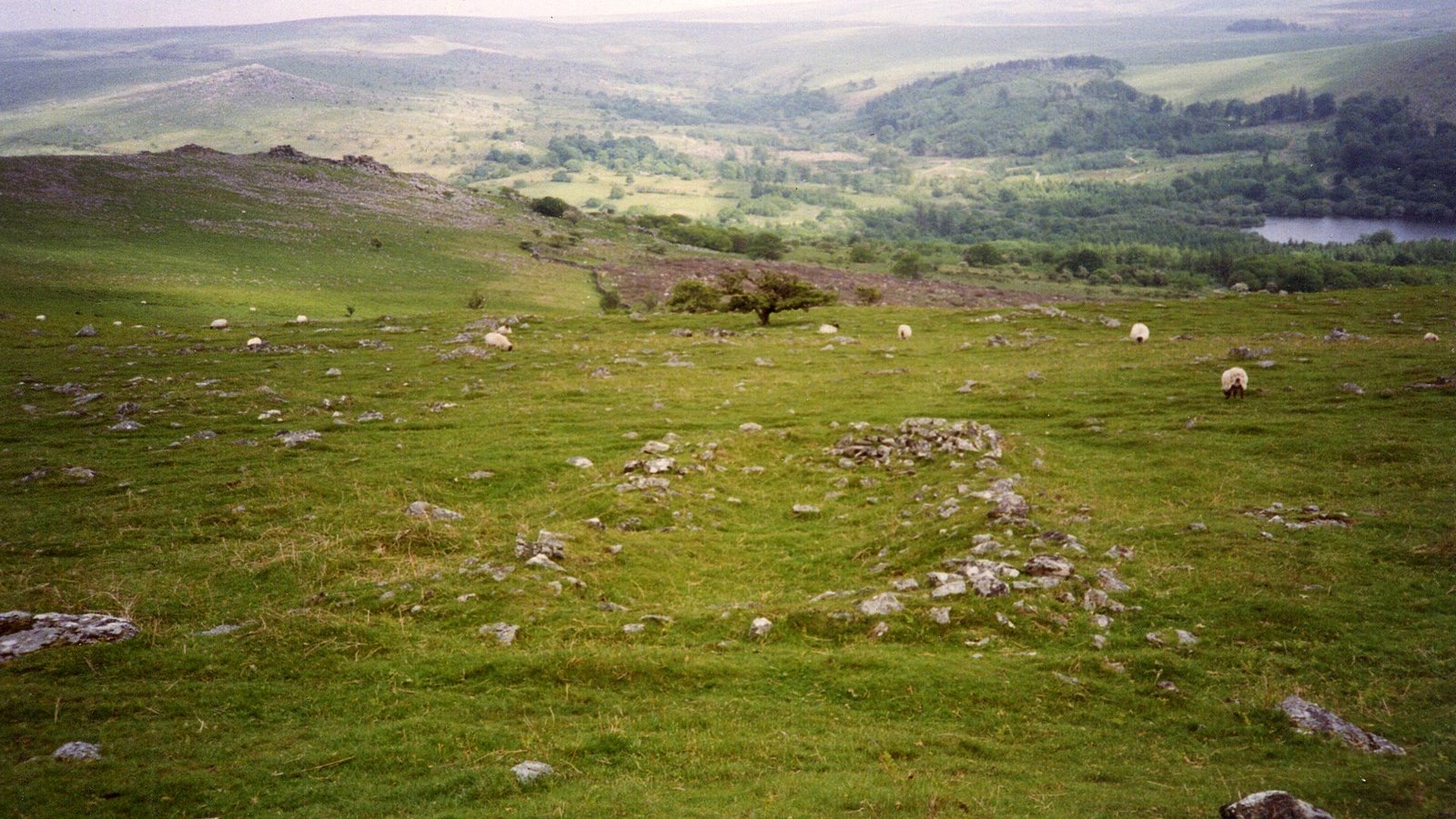 DESERTED MEDIEVAL VILLAGE · Expanded physical oddities
Medieval settlement on Peek Hill, 240m and 280m north east of Lowery Tor
United Kingdom
human settlement in Walkhampton, West Devon, England, UK
Map, evidence and context →DESERTED MEDIEVAL VILLAGE · Expanded physical odditiesMedieval settlement of Little Piddle
United Kingdom
human settlement in Piddlehinton, Dorset, England, UK
Map, evidence and context →DESERTED MEDIEVAL VILLAGE · Expanded physical odditiesMedieval settlement of North Louvard
United Kingdom
human settlement in Piddlehinton, Dorset, England, UK
Map, evidence and context →DESERTED MEDIEVAL VILLAGE · Expanded physical odditiesNether Chalford medieval settlement
United Kingdom
human settlement in Enstone, West Oxfordshire, England, UK
Map, evidence and context →DESERTED MEDIEVAL VILLAGE · Expanded physical odditiesMedieval settlement of Sheldon
United Kingdom
human settlement in Chippenham Without, Wiltshire, England, UK
Map, evidence and context →DESERTED MEDIEVAL VILLAGE · Expanded physical odditiesMedieval settlement and church of Asterleigh
United Kingdom
human settlement in Kiddington with Asterleigh, West Oxfordshire, England, UK
Map, evidence and context →DESERTED MEDIEVAL VILLAGE · Expanded physical odditiesMedieval settlement of Widford immediately east of Manor Farm
United Kingdom
human settlement in Swinbrook and Widford, West Oxfordshire, England, UK
Map, evidence and context →DESERTED MEDIEVAL VILLAGE · Expanded physical odditiesMedieval settlement at Afflington
United Kingdom
human settlement in Corfe Castle, Dorset, England, UK
Map, evidence and context →DESERTED MEDIEVAL VILLAGE · Expanded physical odditiesMedieval settlement remains at Chesterton Green
United Kingdom
human settlement in Chesterton and Kingston, Stratford-on-Avon, Warwickshire, England, UK
Map, evidence and context →DESERTED MEDIEVAL VILLAGE · Expanded physical odditiesMedieval settlement and moated site at Bruton
United Kingdom
human settlement in Whitchurch, Stratford-on-Avon, Warwickshire, England, UK
Map, evidence and context →DESERTED MEDIEVAL VILLAGE · Expanded physical odditiesMedieval settlement at Much Cowarne, immediately south east of Mill House
United Kingdom
human settlement in Much Cowarne, Herefordshire, England,UK
Map, evidence and context →DESERTED MEDIEVAL VILLAGE · Expanded physical odditiesMedieval village including monastic college, chapel, moat, fishponds, dovecote and open field system 200m south of Manor Farm
United Kingdom
human settlement in Sibthorpe, Rushcliffe, Nottinghamshire, England, UK
Map, evidence and context →DESERTED MEDIEVAL VILLAGE · Expanded physical odditiesMedieval settlement remains at Sevenhampton
United Kingdom
human settlement in Highworth, Swindon, Wiltshire, England, UK
Map, evidence and context →DESERTED MEDIEVAL VILLAGE · Expanded physical odditiesMedieval settlement at Cooper's Bank Farm
United Kingdom
human settlement in Dudley, West Midlands, England, UK
Map, evidence and context →DESERTED MEDIEVAL VILLAGE · Expanded physical odditiesMedieval settlement and part of an open field system, 250m north west of Callow Hall
United Kingdom
human settlement in Callow, Derbyshire Dales, Derbyshire, England, UK
Map, evidence and context →DESERTED MEDIEVAL VILLAGE · Expanded physical odditiesSouth Cowton deserted medieval village, immediately south west of Cowton Castle
United Kingdom
human settlement in South Cowton, Hambleton, North Yorkshire, England, UK
Map, evidence and context →DESERTED MEDIEVAL VILLAGE · Expanded physical odditiesMedieval settlement and field system, two bastles and a corn drying kiln, immediately north east of Bradley Hall
United Kingdom
human settlement in Bardon Mill, Northumberland, England, UK
Map, evidence and context →DESERTED MEDIEVAL VILLAGE · Expanded physical odditiesMedieval settlement at Mill Ford Farm
United Kingdom
human settlement in Coughton, Stratford-on-Avon, Warwickshire, England, UK
Map, evidence and context →DESERTED MEDIEVAL VILLAGE · Expanded physical odditiesMedieval village remains immediately south of the church
United Kingdom
human settlement in Carlton Curlieu, Harborough, Leicestershire, England, UK
Map, evidence and context →DESERTED MEDIEVAL VILLAGE · Expanded physical odditiesMedieval settlement remains 300m south east and 150m north of Wistow Hall
United Kingdom
human settlement in Wistow, Harborough, Leicestershire, England, UK
Map, evidence and context →DESERTED MEDIEVAL VILLAGE · Expanded physical odditiesFrisby medieval village remains
United Kingdom
deserted medieval village in Frisby, Leicestershire, England, UK
Map, evidence and context →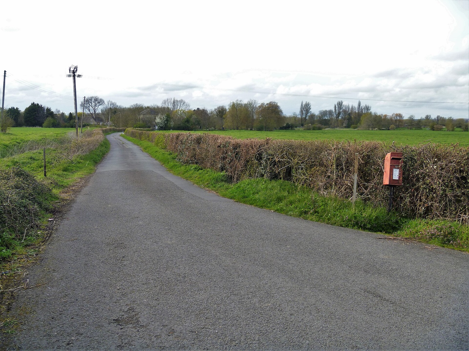 DESERTED MEDIEVAL VILLAGE · Expanded physical oddities
Medieval settlement remains at Inglesham
United Kingdom
human settlement in Inglesham, Swindon, Wiltshire, England, UK
Map, evidence and context →DESERTED MEDIEVAL VILLAGE · Expanded physical odditiesMedieval settlement remains at Hodnell Manor
United Kingdom
human settlement in Hodnell and Wills Pastures, Stratford-on-Avon, Warwickshire, England, UK
Map, evidence and context →DESERTED MEDIEVAL VILLAGE · Expanded physical odditiesMedieval settlement, including site of chapel and part of the open field system, immediately north east of Alkmonton Old Hall Fa
United Kingdom
deserted medieval village in Derbyshire, England, UK
Map, evidence and context →DESERTED MEDIEVAL VILLAGE · Expanded physical odditiesMedieval settlement, including open field system, immediately west of Bentley Fields Farm
United Kingdom
human settlement in Hungry Bentley, Derbyshire Dales, Derbyshire, England, UK
Map, evidence and context →DESERTED MEDIEVAL VILLAGE · Expanded physical odditiesDeserted medieval village of Newsham
United Kingdom
deserted medieval village in Bempton, East Riding of Yorkshire, England, UK
Map, evidence and context →DESERTED MEDIEVAL VILLAGE · Expanded physical odditiesMedieval settlement remains 100m south east and 150m south west of Oldlands Farm, Tinsley Green
United Kingdom
human settlement in Crawley, West Sussex, England, UK
Map, evidence and context →DESERTED MEDIEVAL VILLAGE · Expanded physical odditiesMedieval settlement remains at Shillingthorpe Park
United Kingdom
human settlement in Braceborough and Wilsthorpe, South Kesteven, Lincolnshire, England, UK
Map, evidence and context →DESERTED MEDIEVAL VILLAGE · Expanded physical odditiesMedieval settlement and associated field system immediately south of Ballidon village
United Kingdom
human settlement in Ballidon, Derbyshire Dales, Derbyshire, England, UK
Map, evidence and context →DESERTED MEDIEVAL VILLAGE · Expanded physical odditiesMedieval settlement on the north western slopes of Cales Dale, 490m north west of Cales Farm
United Kingdom
human settlement in Monyash, Derbyshire Dales, Derbyshire, England, UK
Map, evidence and context →